
More details
Collapse details
Date Published:
Filesize:
- November 25, 2013
Navy Marine Species Observers (MSOs) monitored UNDET training exercises at the Pu‘uloa Underwater Range, located west of the Pearl Harbor entrance channel, on 2 and 4 April 2013. The intent of the exercises was to provide training in precision cutting for harbor clearance or salvage. The primary purpose of the MSO presence was to monitor mitigation measures conducted by Mobile Diving and Salvage Unit 1 (MDSU-1); however, visual surveys were also conducted opportunistically.
- 3,893.15 KB
More details
Collapse details
Date Published:
Filesize:
- August 1, 2016
The ultimate goal of this study is to provide the United States (U.S.) Navy with the necessary data to help identify seasonal areas where cheloniid sea turtles are likely to occur in order to inform U.S. Navy environmental planning efforts. This project focuses on the three cheloniid sea turtle species commonly seen in Virginia.
- 4,712.58 KB
More details
Collapse details
Date Published:
Filesize:
- April 1, 2018
Five species of sea turtles occur in Chesapeake Bay and the coastal waters of Virginia with varying regularity. They include the loggerhead turtle (Caretta caretta), Kemp’s ridley turtle (Lepidochelys kempii), green turtle (Chelonia mydas), leatherback turtle (Dermochelys coriacea), and hawksbill turtle (Eretmochelys imbricata) (Musick and Limpus 1997). Loggerhead and Kemp’s ridley turtles are the most abundant and regularly occurring species, and green turtle numbers have increased over the past two decades in Virginia (Barco et al. 2015, Swingle et al. 2014, 2015, 2016).
- 1,259.42 KB
More details
Collapse details
Date Published:
Filesize:
- April 1, 2014
The goal of the project is to assess the occurrence, habitat use, and behavior of loggerhead, green, and Kemp's ridley turtles in the Hampton Roads region to better assess the impacts that U.S. Navy activities may have on these protected species.
- 1,337.08 KB
More details
Collapse details
Date Published:
Filesize:
- February 28, 2015
The ultimate goal of this study is to provide the US NAVY with the necessary data to help identify seasonal areas where cheloniid sea turtles are likely to occur in order to inform DOD sea turtle protection efforts. This project focuses on the three cheloniid sea turtle species commonly seen in Virginia, which are the loggerhead sea turtle, Kemp’s ridley sea turtle, and green sea turtle (Hager 2014).
- 6,910.62 KB
More details
Collapse details
Date Published:
Filesize:
- March 1, 2019
Kemp’s Ridley Tagging and Tracking in Chesapeake Bay and Costal Waters of Virginia: Final Report
- 285.40 KB
More details
Collapse details
Date Published:
Filesize:
- June 1, 2017
The goal of this report is to provide the United States (U.S.) Department of the Navy (Navy) with the necessary data to help identify seasonal areas where Kemp’s ridley and green turtles are likely to occur in order to inform Navy environmental planning efforts.
- 1,296.69 KB
Acoustic telemetry with sea turtles in Virginia.
GARSCON 2015 (Greater Atlantic Region Stranding Conference 2015). .
More details
Collapse details
Date Published:
Filesize:
- October 1, 2015
The Virginia Aquarium Foundation (VAQF) and the U.S. Navy have been working together since 2013 to determine the efficacy of using acoustic telemetry for investigating the fine scale movements of sea turtles in the vicinity of Navy facilities in southeastern Virginia. To date, we have deployed 56 acoustic tags (VEMCO V16, V13 and V9 69 kilohertz tags), 14 from Jul-Nov of 2013, 24 in 2014 and 18 May-Jul of 2015. The U.S. Navy maintains an array of 71 acoustic receivers (VEMCO VR2W) in southeastern Virginia and downloads and processes data every other month. There is a four to six month delay from the time of detection to VAQF receiving processed tag detection data. For this reason, we will discuss results for turtles tagged in 2013 and 2014. Of the 38 turtles tagged in 2013-14, five were wild caught (incidentally or directly captured) and 33 were stranded, rehabilitated and released. Of the stranded turtles, 14 were caught on recreational hook and line, 13 were cold-stunned and the rest were boat strikes (n=3), diseased (n=2) or entangled in other gear (n=1). In total we deployed tags on 18 loggerheads, 15 Kemp’s ridleys (one was released twice) and 4 green turtles. Of these 15 (83%) of the loggerheads were detected, 11 (73%) of the Kemp’s ridleys were detected and 3 (75%) of the greens were detected. Seven of the turtles stranded dead since release (3 wild and 4 stranded) and of these one was never detected. Seven turtles were released after mid-Oct south of the Navy receiver array and, of these, four were never detected. For loggerheads, Kemp’s and greens that were detected, mean number of detections were 220, 57, and 187, number of different days detected were 6, 3, and 10, and days post-release were 97, 21, and 53 respectively.
- 9,579.31 KB
Navy collaborates, monitors to better understand sea turtle movements in San Diego Bay.
Currents (Navy's Environmental Magazine). 2015.
Winter 2015/2016:6-13
More details
Collapse details
Date Published:
Filesize:
- December 1, 2015
Since the closure of a power plant in the southern part of San Diego Bay, a collaborative monitoring effort among the Navy, the National Marine Fisheries Service (NMFS) and others has been underway to better understand changes in the movement and behavior of the green sea turtle so that the Navy and this turtle can continue to share the resources in the bay. San Diego Bay is home to one of the largest U.S. Navy complexes in the world and California’s second largest incorporated city. Today, more than 25 percent of the U.S. Navy fleet is homeported in San Diego. Maintaining readiness in this ecosystem without causing harm to the natural resources is an ongoing challenge. There are a variety of threatened and endangered species that rely on the San Diego Bay ecosystem at different stages of their lives. One of these is the East Pacific green sea turtle. The East Pacific green sea turtle is a federally threatened species in San Diego Bay. While the majority of the population has traditionally lived in the quieter south part of the bay, the turtles may be venturing into areas more frequently used for U.S. Navy, recreational, and commercial activities. An increased presence of turtles outside of the southern portion of the bay may have potential implications for management of this species, as there is a higher likelihood of boat strikes and other potentially adverse human interactions.
- 2,037.95 KB
More details
Collapse details
Date Published:
Filesize:
- March 24, 2013
In order to train with mid-frequency active sonar (MFAS), the United States (U.S.) Navy has obtained a permit from the National Marine Fisheries Service (NMFS) under the Marine Mammal Protection Act and Biological Opinion under the Endangered Species Act. The Mariana Islands Range Complex (MIRC) Monitoring Plan was developed with NMFS to comply with the requirements under the permits. The monitoring plan and reporting requirements provide science-based answers to questions regarding whether or not marine mammals are exposed to, and react to, Navy MFAS and explosives. As such, the Navy developed the MIRC Monitoring Plan to conduct activities that meet these monitoring goals.
- 2,561.29 KB
More details
Collapse details
Date Published:
Filesize:
- May 1, 2014
In order to train with mid-frequency active sonar (MFAS), the United States (U.S.) Navy has obtained a permit from the National Marine Fisheries Service (NMFS) under the Marine Mammal Protection Act (MMPA) and a Biological Opinion under the Endangered Species Act (ESA). The Navy has developed Monitoring Plans for individual Navy Range Complexes, guided by the Integrated Comprehensive Monitoring Program (ICMP), to provide marine mammal and sea turtle monitoring guidelines as required under the MMPA and the ESA (Department of the Navy 2010). The Hawaii Range Complex (HRC) Monitoring Plan, implemented in 2014, was developed with NMFS to comply with the requirements under the permits (Department of the Navy 2014). The ICMP provides the overarching framework for coordination of the U.S. Navy Monitoring Program (Department of the Navy 2010). The ICMP outlines objectives for range/project-specific Monitoring Plans and U.S. Navy-funded research relating to the effects of naval training and testing activities on protected marine species (Department of the Navy 2010).
- 2,787.98 KB
More details
Collapse details
Date Published:
Filesize:
- July 8, 2026
Building on Year 1 deployments, Year 2 moved the study toward providing robust, defensible availability bias models for green and Kemp’s ridley sea turtles on the East Coast. The current study results should be interpreted with caution, given the relatively small number of deployments to date, particularly for Kemp’s ridley turtles (n=10 deployments), which limits the available information both spatially and temporally. Collecting 18 months of data and expanding the analysis, compared to 6 months when the 2024 annual report (DiMatteo and Mansfield 2025) was written, reinforced several findings. Availability bias generally increased as the depth threshold at which animals were assumed to be able to be seen increased. This is to be expected as more of the water column is considered to be visible. The availability bias estimates from the 2-m depth histograms and dive behavior were similar.
- 13,940.82 KB
More details
Collapse details
Date Published:
Filesize:
- February 1, 2025
The study team proposed deploying up to 50 Wildlife Computers satellite-linked telemetry tags per year for 3 years, split evenly between Kemp’s ridley and green sea turtles (or as encounters allow), at several sites along the East Coast ranging from Florida (FL) to Massachusetts (MA). In partnership with several rehabilitation and research groups, the study team aims to collect and record sea turtle behavioral data in multiple representative environments and times of year
- 4,815.55 KB
Sea turtle density surface models along the United States Atlantic coast.
Endangered Species Research. 2024.
53:227–245
More details
Collapse details
Date Published:
Publication:Ocean:Region:Species:Methods:
- February 29, 2024
Spatially explicit estimates of marine species distribution and abundance are required to quantify potential impacts from human activities such as military training and testing, fisheries interactions, and offshore energy development. There are 4 protected species of sea turtle (loggerhead, green, Kemp’s ridley, and leatherback) commonly found along the east coast of the USA, our study area, and which require impact assessments.
More details
Collapse details
Date Published:
Filesize:
- June 1, 2011
In order to address requirements under the Marine Mammal Protection Act Letters of Authorization permitted to the U.S. Navy, three U.S. Navy civilian marine mammal observers (MMOs; Ms. Amy Farak, Ms. Julie Rivers, and Dr. Robert Uyeyama) and one U.S. Navy contractor (Dr. Thomas A. Jefferson) participated in two consecutive ASW exercise events in the Hawaii Range Complex from 15‐22 February, 2011 (Figure 1). These MMOs were stationed aboard a U.S. Navy destroyer, hereafter referred to as DDG‐D. The goals of the monitoring and this study were to: 1. Collect data to assess the effectiveness of the Navy lookout team. 2. Obtain data to characterize the possible exposure of marine species to mid‐frequency active sonar (MFAS). 3. Achieve close coordination between the contracted aerial survey team, Navy aircraft on the range, range control, and th
- 920.44 KB
More details
Collapse details
Date Published:
Filesize:
- February 1, 2011
The monitoring plan and reporting will provide science‐based answers to questions regarding whether or not marine mammals are exposed and reacting to Navy MFAS. The objectives of the monitoring plan are to address the following questions: 1. Are marine mammals and sea turtles exposed to MFAS at regulatory thresholds of harm or harassment? If so, at what levels and how frequently are they exposed? 2. If marine mammals and sea turtles are exposed to MFAS in the HRC, do they redistribute geographically in the HRC as a result of repeated exposure? If so, how long does the redistribution last? 3. If marine mammals and sea turtles are exposed to MFAS, what are their behavioral responses? Are they different at various levels? 4. What are the behavioral responses of marine mammals and sea turtles that are exposed to various levels and distances from explosives? 5. Are the Navy’s suite of mitigation measures for MFAS and explosives (e.g., Protective Measures Assessment Protocol [PMAP], measures agreed to by the Navy through permitting and consultation) effective at avoiding harm or harassment of marine mammals and sea turtles?
- 532.11 KB
More details
Collapse details
Date Published:
Filesize:
- February 1, 2022
In 2013, under an inter-agency agreement (IAA) between the United States Navy and the National Oceanic and Atmospheric Administration (NOAA), NOAA began conducting in-water surveys to record and quantify observations of marine turtles around the Mariana Archipelago. When observed, attempts were made to hand-capture turtles and equipthem with satellite tags in an effort to better understand their spatial ecology.
- 349.81 KB
More details
Collapse details
Date Published:
Filesize:
- February 1, 2021
The United States Navy developed monitoring questions for the Mariana Islands Training and Testing (MITT) study area under the Mariana Islands Range Complex Monitoring Plan (MIRCMP), including questions specifically related to marine turtles as required under the Endangered Species Act (ESA) of 1973. To support the needs of the U.S. Pacific Fleet Environmental Readiness Office, the Marine Turtle Biology and Assessment Program (MTBAP) of the National Oceanic and Atmospheric Administration (NOAA) has been conducting research on marine turtle abundance and spatial-temporal ecology in the nearshore waters of Saipan, Tinian, and Guam since 2013, under a series of Interagency Agreements (IAA).
- 674.99 KB
More details
Collapse details
Date Published:
Filesize:
- January 1, 2024
Understanding the spatio-temporal movements of animals is an integral component of wildlife conservation and management. Sea turtles are species of conservation concern and satellite telemetry is a primary research tool used to study their movements, providing high accuracy location data in near “real time,” thus facilitating rapid identification of movements and key habitats.
- 5,706.75 KB
More details
Collapse details
Date Published:
Filesize:
- January 1, 2020
Understanding the spatio-temporal movements of animals is an integral component of wildlife conservation and management. Marine turtles are species of conservation concern and satellite telemetry is a primary research tool used to study their movements, providing high accuracy location data in near “real time”, thus facilitating rapid identification of movements and key habitats.
- 5,020.67 KB
More details
Collapse details
Date Published:
Filesize:
- December 1, 2011
The objective of this current survey effort was to conduct baseline surveys to further document marine mammal and sea turtle occurrence in nearshore waters around the island of Guam. This report presents the results of the Guam Marine Species Monitoring Survey conducted on the MV Island Girl from February 17 to March 3, 2011.
- 786.14 KB
More details
Collapse details
Date Published:
Filesize:
- August 31, 2012
The overall objective of the ICMP is to assimilate relevant data collected across U.S. Navy range complexes in order to answer questions pertaining to the impact of MFAS and explosives on marine mammals and sea turtles.
- 11,672.29 KB
More details
Collapse details
Date Published:
Filesize:
- November 1, 2012
The first phase to integrate the historical sum of these U.S. Navy-sponsored visual survey efforts for marine species monitoring in the HRC was prepared by Uyeyama (2011). This report represents the second phase of that effort and presents an overview of monitoring survey effort to date in the HRC. Available data from visual surveys performed by both contractor-led efforts and U.S. Navy in-house surveys was compiled and processed in order to: 1. Create a geographic information system (GIS)-based summation of all survey tracks that can be easily visualized. 2. Construct a geo-referenced database of sightings that can be queried by species, observer platform, Beaufort Sea State (BSS), season, or other sighting/survey variables. 3. Conduct an enhanced analysis of sighting success with respect to survey platform, field protocol, and environmental conditions. 4. Inform and adjust data collection procedures on future surveys as needed to reflect lessons learned from sighting data compilation efforts presented here. 5. Provide information to enhance informed management of marine protected species in the HRC and support the adaptive management process that is part of the ICM
- 19,704.58 KB
- Hawaiian Monk Seal
- Green turtle
- Bryde's whale
- Humpback whale
- Minke whale
- Sei whale
- Blainville's beaked whale
- Bottlenose dolphin
- Goose-beaked whale
- Fraser's dolphin
- Killer whale
- Longman’s beaked whale
- Melon-headed whale
- Pantropical spotted dolphin
- Pygmy killer whale
- Risso's dolphin
- Rough-toothed dolphin
- Short-finned pilot whale
- Spinner dolphin
- Striped dolphin
More details
Collapse details
Date Published:
Filesize:
- March 1, 2012
This report presents the results of the Guam and Saipan Marine Species Monitoring: Winter-Spring Survey conducted on the motor vessel (M/V) Sea Fantasy (Guam survey) and the M/V Super Emerald (Saipan survey) from 15 to 29 March 2012. The objective of the 2012 survey effort was to conduct baseline surveys to further document marine mammal and sea turtle occurrence in nearshore waters around the island of Guam and Saipan. The approach primarily followed opportunistic survey protocols used in recent surveys around Guam (Ligon et al. 2011; HDR 2011), which remained within 10 kilometers (km) or 5.4 nautical miles (NM) of the coastline.
- 998.39 KB
More details
Collapse details
Date Published:
Filesize:
- September 19, 2024
This report presents a geographic information system (GIS)-based overview of the sighting records obtained during marine species monitoring effort (a total of 12 U.S. Pacific Fleet-funded surveys) to date in the MIRC. Also included are incidental marine mammal and sea turtle sightings made since 1965 on non-dedicated surveys in the region.
- 14,571.64 KB
More details
Collapse details
Date Published:
Filesize:
- March 2, 2017
The Pacific Islands Fisheries Science Center’s (PIFSC) Cetacean Research Program (CRP) has been conducting visual surveys and long-term acoustic monitoring for cetaceans in the waters surrounding Guam and the Commonwealth of the Northern Mariana Islands (CNMI) as part of an ongoing effort to develop a record of cetacean occurrence in the region. Visual surveys have been conducted aboard small boats (7.6-12.2 m) since 2010 off the southernmost islands of the Mariana Archipelago (Guam, Rota, Saipan, Tinian, and Aguijan). These surveys include the collection of photographs for individual identification, tissue samples for genetic analysis of population structure, and the deployment of satellite tags for assessment of individual movements throughout the broader region
- 2,999.73 KB
More details
Collapse details
Date Published:
Filesize:
- February 1, 2013
A long-term goal of this research is the evaluation of the population status of each cetacean stock. This includes producing population abundance estimates using mark-recapture techniques. The first step in the process is the creation of species photo-identification catalogs, which began during the summer of 2012
- 2,353.37 KB
More details
Collapse details
Date Published:
Filesize:
- January 31, 2013
The U.S. Navy developed the Mariana Islands Range Complex (MIRC) Monitoring Plan to provide required monitoring of protected species under the Marine Mammal Protection Act (1972) and the Endangered Species Act (1973). Of the 5 species of sea turtle associated with the MIRC this interim report provides preliminary data on the habitat and movements of green turtles (Chelonia mydas) and hawksbill turtles (Eretmochelys imbricata) in the nearshore waters of Saipan, Tinian, Guam – and the waters in between during migration.
- 1,200.48 KB
More details
Collapse details
Date Published:
Filesize:
- January 15, 2016
This report summarizes field research activities conducted in November 2015 by the PIFSC Marine Turtle Biology and Assessment Program (MTBAP), in collaboration with local partners on Saipan and Guam
- 924.60 KB
More details
Collapse details
Date Published:
Filesize:
- May 1, 2014
There are two questions from the FY13-15 Monitoring Plan that primarily guide this project. First, are there locations of greater cetacean and/or sea turtle concentration around Guam, Saipan and Tinian? Second, what is the occurrence and/or habitat use of sea turtles in areas that the Navy conducts underwater detonations?
- 1,874.51 KB
More details
Collapse details
Date Published:
Filesize:
- September 1, 2015
Sea Turtle Tagging in MIRC (Progress Report) -2014 progress report
- 2,020.53 KB
More details
Collapse details
Date Published:
Filesize:
- August 1, 2009
In order to train with mid-frequency active sonar (MFAS), the Navy has obtained a permit from the National Marine Fisheries Service (NMFS) under the Marine Mammal Protection Act and Endangered Species Act. The Hawaii Range Complex (HRC) Monitoring Plan, finalized in December 2008 for implementation in January 2009, was developed with NMFS to comply with the requirements under the permit. The monitoring plan and reporting will provide sciencebased answers to questions regarding whether or not marine mammals are exposed and reacting to Navy MFAS. The objectives of the monitoring plan are to answer the following questions: 1. Are marine mammals and sea turtles exposed to MFAS at regulatory thresholds of harm or harassment? If so, at what levels and how frequently are they exposed? 2. If marine mammals and sea turtles are exposed to MFAS in the HRC, do they redistribute geographically in the HRC as a result of repeated exposure? If so, how long does the redistribution last? 3. If marine mammals and sea turtles are exposed to MFAS, what are their behavioral responses? Are they different at various levels? 4. What are the behavioral responses of marine mammals and sea turtles that are exposed to various levels and distances from explosives? 5. Are the Navy’s suite of mitigation measures for MFAS and explosives (e.g., Protective Measures Assessment Protocol [PMAP], measures agreed to by the Navy through permitting and consultation) effe
- 1,399.23 KB
More details
Collapse details
Date Published:
Filesize:
- December 15, 2016
This report summarizes field research activities conducted between 23 October and 24 November 2016 by the PIFSC Marine Turtle Biology and Assessment Program (MTBAP), in collaboration with local partners on Saipan and Guam
- 2,422.75 KB
More details
Collapse details
Date Published:
Filesize:
- January 31, 2019
The overall objective is to collect field data that will enable the Navy and the NMFS to better understand the distribution and habitat use of sea turtles in Guam and the CNMI.
- 3,376.54 KB
More details
Collapse details
Date Published:
Filesize:
- January 31, 2018
The Marine Turtle Biology and Assessment Program (PIFSC, NOAA Fisheries), together with local partners, conducts marine turtle surveys and in-water captures of green turtles (Chelonia mydas) and hawksbill turtles (Eretmochelys imbricata).
- 3,653.04 KB
More details
Collapse details
Date Published:
- January 10, 2016
More details
Collapse details
Date Published:
Filesize:
- June 3, 2011
Aerial Survey Monitoring for Marine Mammals and Sea Turtles in the Hawaii Range Complex in Conjunction with Two Navy Training Events. SCC and USWEX February 16 ‐ March 5, 2011. Final Field Report.
- 1,239.74 KB
More details
Collapse details
Date Published:
Filesize:
- July 1, 2012
Aerial surveys to monitor marine mammals and sea turtles (MM/ST) were conducted in conjunction with a U.S. Commander Pacific Fleet (COMPACFLT) training event in the Hawaii Range Complex (HRC) on the Pacific Missile Range Facility (PMRF) Barking Sands Tactical Underwater Range (BARSTUR) and Barking Sands Underwater Range Extension (BSURE) between Kauai and Ni'ihau, Hawaii during the period February 15 to 25, 2012
- 1,498.37 KB
More details
Collapse details
Date Published:
Filesize:
- March 1, 2016
In December 2010, the South Bay Power Plant (SBPP) was decommissioned. Changes to green turtle (Chelonia mydas) behaviors were most likely a result of the cessation of the warm-water effluent that resulted in decreasing water temperatures. Although South Bay will most likely remain the preferred habitat for San Diego Bay (SDB) green turtles, it is possible the range of these turtles may expand out of South Bay and into other more frequently used parts of SDB. An increased presence of turtles outside of the southern portion of SDB may have potential implications for management of this species, as there is a greater likelihood of boat strike and potential interactions with U.S. Navy, commercial, and recreational activities
- 1,832.64 KB
More details
Collapse details
Date Published:
Filesize:
- March 22, 2022
The United States (US) Navy uses lookouts (LOs) to detect objects in the water in the vicinity of ships. One class of object that LOs are trained to detect is marine mammals ; this forms an important component of the Navy’s procedures for marine mammal mitigation during training activities . As well as dedications of marine mammals by these LOs, detections of marine mammals may also be made by other members of the ship’s crew such as officers on the bridge (“watchstanders”) or sonar technicians, although acoustic detections require visual confirmation. We refer to these personnel together as the “lookout team” (LT). The primary goal of this project was to determine how effective LTs are at detecting marin
- 4,078.84 KB
- California sea lion
- Green turtle
- Leatherback turtle
- Loggerhead turtle
- Kemp's Ridley turtle
- Blue whale
- Fin whale
- Humpback whale
- Minke whale
- Atlantic white-sided dolphin
- Common dolphin
- Harbor porpoise
- Killer whale
- Pantropical spotted dolphin
- Pilot whale
- Risso's dolphin
- Rough-toothed dolphin
- Short-finned pilot whale
- Sperm whale
- Spotted dolphin
- Striped dolphin
More details
Collapse details
Date Published:
Filesize:
- July 1, 2006
In support of RIMPAC 2006, nearshore monitoring for marine mammals and sea turtles was conducted during July 16-20 from Kekaha Beach, Kauai, Hawaii and July 24-26 from Mahukona and Kapa`a Beach Park, Kohala Coast, Hawaii
- 180.16 KB
More details
Collapse details
Date Published:
Filesize:
- May 1, 2014
In order to train with mid-frequency active sonar (MFAS), the United States (U.S.) Navy has obtained a permit from the National Marine Fisheries Service (NMFS) under the Marine Mammal Protection Act and a Biological Opinion under the Endangered Species Act. The Hawaii Range Complex Monitoring Plan, implemented starting in November 2009, was developed with NMFS to comply with the requirements under the permits.
- 2,225.02 KB
More details
Collapse details
Date Published:
Filesize:
- January 5, 2013
In accordance with the HRC Monitoring Plan, implemented in January 2009, data were collected 18–22 February 2013 during a SCC event, with the following stated goals: (1) collect data to assess the effectiveness of the Navy lookout team, and (2) obtain data to characterize the possible exposure of marine species to MFAS. Three U.S. Navy civilian MMOs (MMOs and one contractor MMO were stationed aboard a U.S. Navy-guided DDG for observation of marine species. MMO surveys were conducted on a not-to-interfere basis, which means that the MMOs did not replace required Navy lookouts and did not dictate operational requirements or maneuvers.
- 2,372.54 KB
Current
Green and Kemp's Ridley Turtle Tagging for Availability Bias Estimates
Project Objectives
Assess availability bias and habitat associations of endangered Kemp’s ridley and threatened green sea turtles to improve spatial density models
Complete
Lower Chesapeake Bay Sea Turtle Tagging and Tracking
Project Objectives
Assess ocurrence and behavior of loggerhead, green, and Kemp's ridley sea turtles in the Hampton Roads region of Chesapeake Bay and coastal Atlantic Ocean
Complete
Sea turtle tagging in the Mariana Islands Range Complex
Project Objectives
Develop a better understanding of sea turtle distribution and habitat use in the Mariana Islands, particularly in relation to locations used by the Navy for underwater detonation training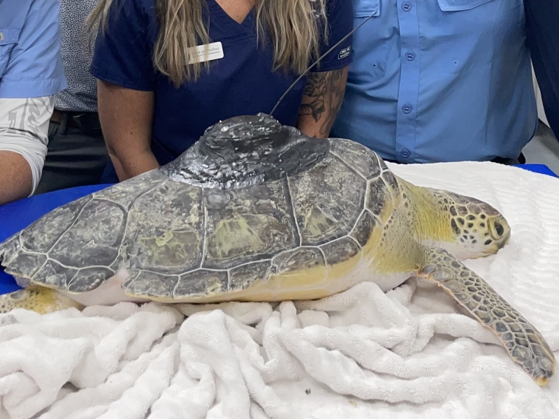
First Tagged Sea Turtle Released from Jekyll Island, Georgia
October 17, 2025
Collaborators at the Jekyll Island Authority in Georgia have released the first satellite-tagged green turtle in Georgia waters under the Navy’s “Green and Kemp's Ridley Turtle Tagging for Availability Bias Estimates” Project.
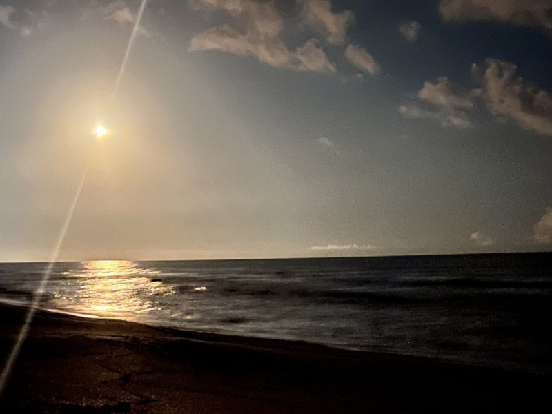
Green turtles are back on the Space Coast
July 21, 2025
A field team led by co-Principle Investigator Dr. Kate Mansfield of the Marine Turtle Research Group at the University of Central Florida kicked off the second year of tagging for our “Kemp’s Ridley and Green Sea Turtle Tagging for Availability Bias Analysis” project.
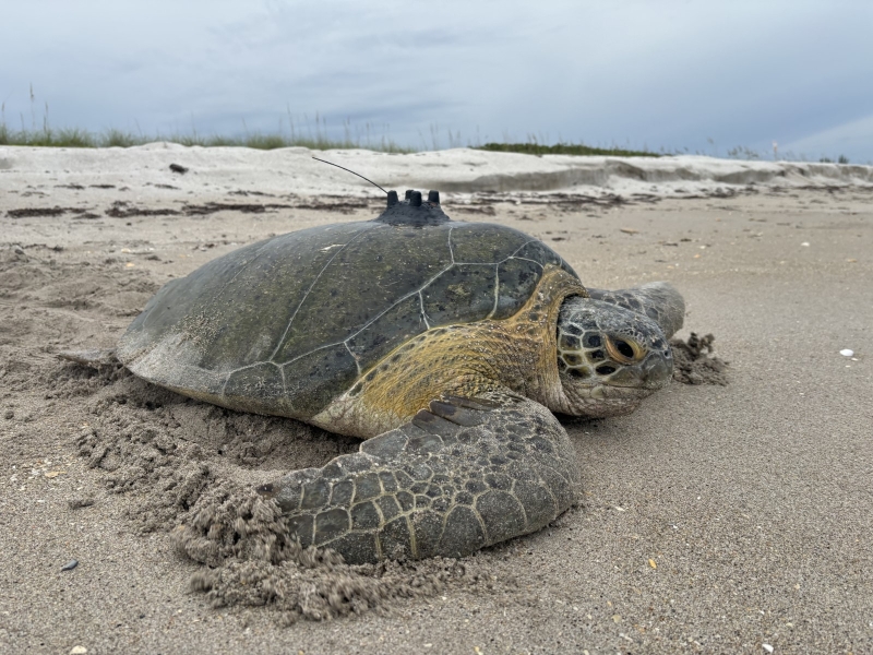
Males have joined the turtle tagging party
July 15, 2024
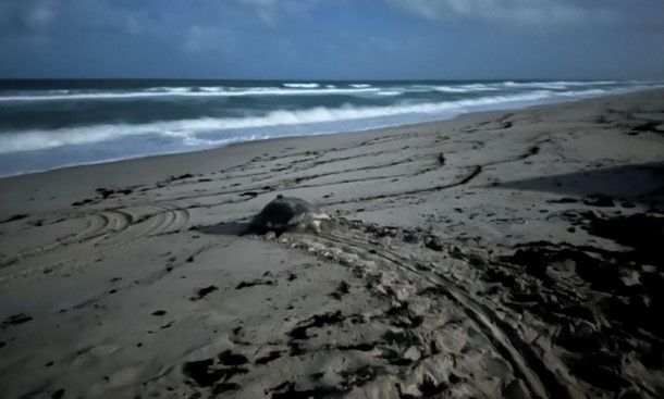
Researchers from Inwater Research Group (IRG), supported by Dr. Kate Mansfield of the UCF Marine Turtle Research Group and Andrew DiMatteo of CheloniData LLC, have deployed a satellite-linked data logger on an adult male green sea turtle in St. Lucie County, Florida. This initiative aims to study the diving behavior and habitat use of male green turtles along the U.S. east coast.
Back in the turtle tagging business
June 28, 2024
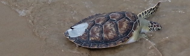
Researchers at the University of Central Florida (UCF), led by Dr. Kate Mansfield and supported by the UCF Marine Turtle Research Group and Andrew DiMatteo of CheloniData LLC, deployed five satellite-linked data loggers on adult nesting green turtles at the Archie Carr National Wildlife Refuge in Florida during the week of June 17th.
Atlantic sea turtle tagging project is underway!
July 17, 2013
The start of a new turtle project.
No related presentations or posters to display
